Plymouth, Michigan, a delightful suburb of Detroit with just over 9,000 residents, offers a mix of small-town charm and strategic metropolitan access. When it comes to getting around this scenic community, residents and visitors have several options to consider. Whether you’re a long-time local looking to optimize your daily commute or a newcomer trying to understand transportation logistics, Plymouth’s manageable size and thoughtful layout make navigation relatively straightforward compared to larger cities.
With its bustling downtown area, proximity to major highways, and variety of residential neighborhoods, Plymouth presents unique commuting considerations. The city features approximately nine railroad crossings that can occasionally impact traffic flow, and rush hour congestion can occur on main arteries. However, most destinations within city limits are accessible within minutes, and the community’s welcoming atmosphere extends to its transportation infrastructure. This guide will explore the various ways to traverse Plymouth, highlighting efficiency, convenience, and practical tips for making the most of your journeys throughout this beloved Michigan community.
Overview of Plymouth’s Transportation Infrastructure
Plymouth’s transportation network is centered around its historic downtown district, with Main Street and Ann Arbor Trail serving as primary east-west thoroughfares and Sheldon Road functioning as a key north-south corridor. The city is conveniently positioned near major regional highways, with I-275 running along its western edge and M-14 providing east-west access just north of town. This strategic location puts downtown Detroit approximately 30 minutes away by car and Ann Arbor about 20 minutes to the west. While Plymouth’s modest size makes navigation relatively simple, residents should be mindful of the numerous railroad crossings that can occasionally cause delays when trains pass through.
The city’s walkable downtown and grid-like street pattern in residential neighborhoods contribute to its navigational ease, though traffic can increase during rush hours and special events. Kellogg Park serves as Plymouth’s central landmark, with surrounding streets often bustling with activity, particularly during Plymouth’s many seasonal festivals and weekend markets. Newer developments in Plymouth Township follow more contemporary suburban layouts with curved streets and cul-de-sacs. The relatively flat terrain makes both driving and active transportation viable options, though winter weather conditions occasionally present challenges for all commuters. Overall, Plymouth’s infrastructure strikes a balance between small-town accessibility and regional connectivity.
- Insights from the State of Transit Report pertaining to Plymouth’s public transit. Source: detroittransit.org
Public Transit Options in Plymouth
The Plymouth Community Senior Transportation Service stands as the city’s primary dedicated public transit option, providing curb-to-curb service for residents aged 60 and older. This service operates Monday through Friday from 9:00 a.m. to 2:30 p.m. and requires reservations at least 48 hours in advance. For just $2.00 per one-way ride, seniors can travel anywhere within Plymouth city limits or township boundaries. Additionally, the service connects to select area hospitals and medical facilities, with monthly special trips to popular shopping destinations like Meijer, Walmart, and Target. While limited to senior citizens, this service represents an essential mobility lifeline for older Plymouth residents.
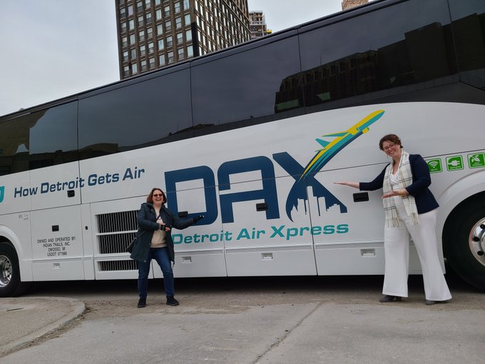
Beyond senior transportation, Plymouth residents can access the broader regional transit network through SMART (Suburban Mobility Authority for Regional Transportation) bus connections in neighboring communities. Though SMART doesn’t directly serve Plymouth’s downtown, connection points are available in nearby communities. For trips to Detroit, commuters often drive to park-and-ride locations to access more robust regional transit options. The Regional Transit Authority’s D2A2 service between Detroit and Ann Arbor provides another transit corridor near Plymouth, with ridership steadily growing in recent years. Transit advocates have noted that metro Detroit transit has been historically underfunded compared to similar regions, though gradual improvements in reliability and service have been observed throughout 2024.
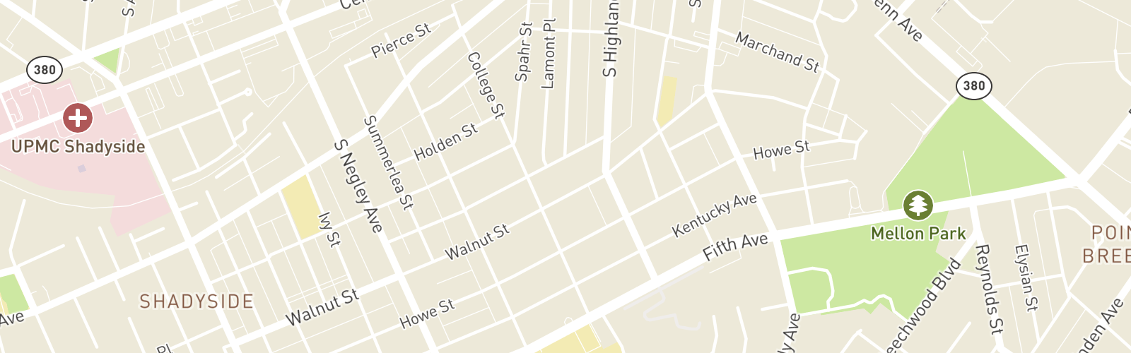
- A map illustrating major roads and routes in Plymouth, MI. Source: niche.com
Driving and Parking in Plymouth
Driving remains the primary transportation method for most Plymouth residents, with typical commute times ranging from 5-10 minutes for destinations within the city to around 30 minutes for Detroit and 20 minutes for Ann Arbor. Rush hour traffic is most notable on major roads like Ann Arbor Road, Main Street, and near I-275 on-ramps, generally between 7:30-9:00 a.m. and 4:30-6:00 p.m. on weekdays. A distinctive feature of driving in Plymouth is navigating around its approximately nine railroad crossings, which can cause unpredictable delays when freight trains pass through. Locals quickly learn alternative routes and often use traffic apps to navigate around these temporary blockages. Winter driving requires additional caution, though Plymouth’s roads are generally well-maintained during snowfall.
Downtown Plymouth offers a combination of street parking (some metered, some free), public lots, and a central parking deck near the intersection of Wing and Harvey streets. During major events like the Plymouth Ice Festival, Art in the Park, or the Fall Festival, parking demand increases significantly, and visitors might need to park farther from downtown and walk. Local knowledge is valuable for finding free parking spaces that remain underutilized even during busy periods. Many downtown businesses validate parking for customers, and most residential areas have ample street parking with few restrictions outside the immediate downtown core. For commuters driving to work outside Plymouth, several park-and-ride locations exist near major highways, facilitating carpooling options.
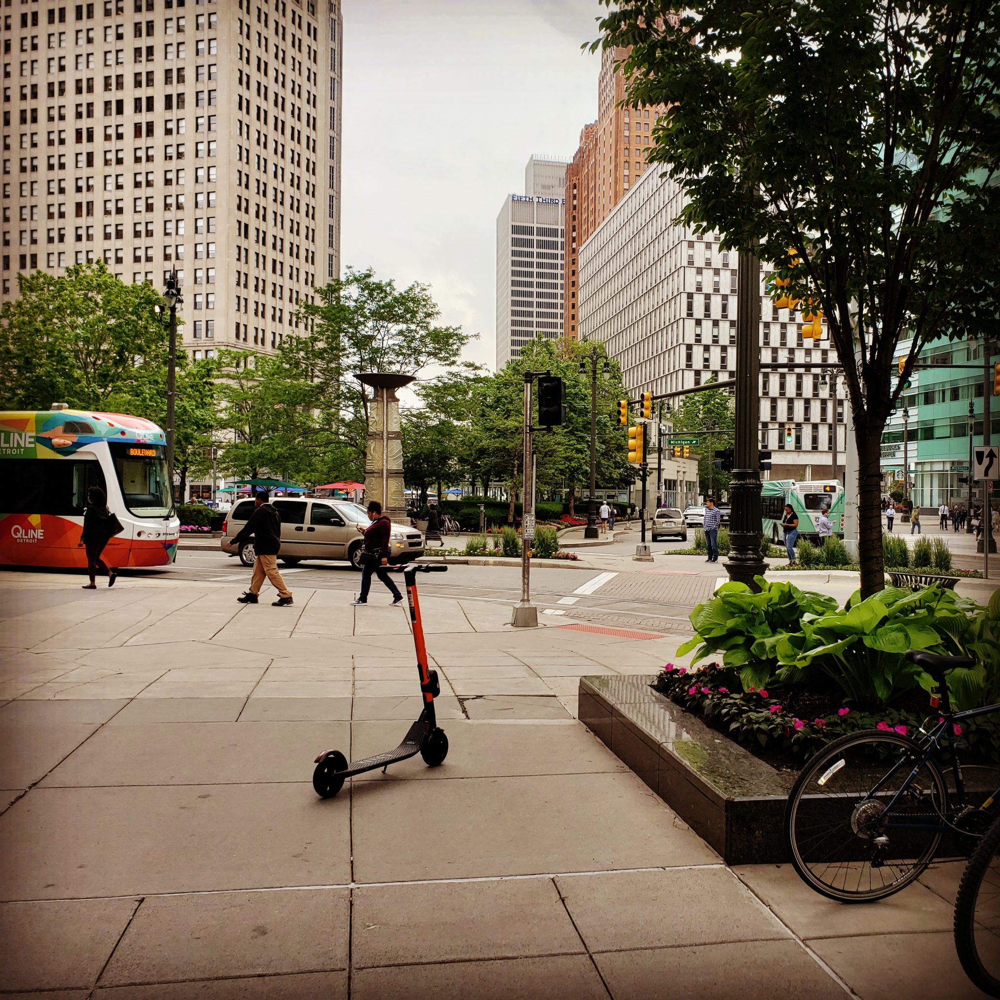
- Exploring multi-modal transportation options in downtown Plymouth, MI. Source: detroittransit.org
Biking, Walking, and Alternative Transportation
Plymouth’s compact downtown and relatively flat terrain make it an increasingly bike-friendly community, with Kellogg Park serving as a central point for cyclists exploring the area. The most popular bike routes include the stretch along Ann Arbor Trail connecting to Hines Drive, which offers miles of dedicated bike paths through Hines Park. Within city limits, Penniman Avenue and Harvey Street provide calmer alternatives to busier Main Street when traversing downtown. Plymouth has been gradually expanding its bike infrastructure, adding designated bike lanes and “share the road” markings on select streets. Safety-conscious cyclists should note that some of Plymouth’s historic streets are narrower and busier during peak times, making route planning essential, especially for less experienced riders.
Walking is a practical and pleasant option for navigating Plymouth’s charming downtown district, where most amenities and shops are within a 10-15 minute walk of each other. The downtown area features well-maintained sidewalks, pedestrian crossings, and street lighting that enhance walkability and safety. Beyond downtown, residential neighborhoods vary in their pedestrian infrastructure, with newer developments sometimes lacking continuous sidewalk networks. Environmental considerations have increasingly prompted Plymouth residents to explore alternative transportation options, including carpooling arrangements and electric vehicles, supported by the growing number of charging stations throughout the community. For those combining transportation modes, bike racks are available at key downtown locations, and many local businesses accommodate cyclists with dedicated parking areas.